Weather
Northern Lights Might Shine Over Parts of the U.S. Thanks to Powerful Geomagnetic Storm
A rare geomagnetic event could bring the aurora borealis to unexpected locations, including parts of Texas and the northern U.S.
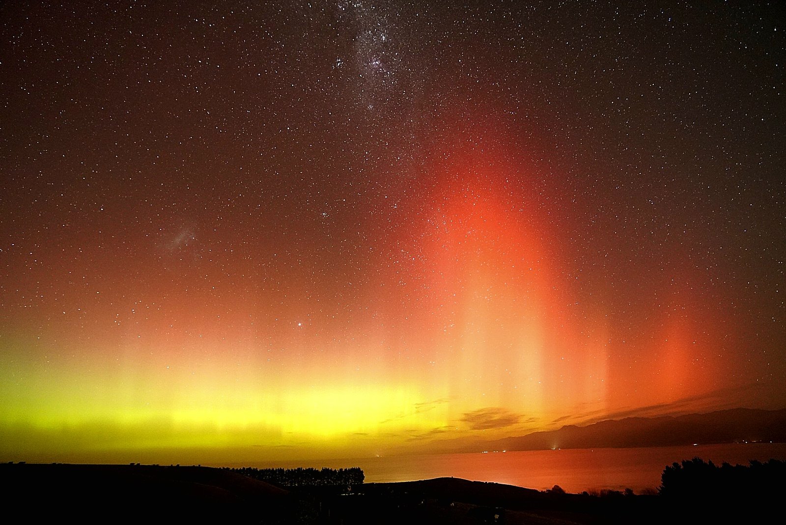
Skywatchers across the U.S. have something to look forward to this weekend as a powerful geomagnetic storm is expected to make the stunning aurora borealis visible far beyond its usual northern homes. According to the National Oceanic and Atmospheric Administration’s (NOAA) Space Weather Prediction Center, the auroras could appear over much of the northern half of the contiguous United States, stretching as far south as northern California and Alabama. This rare celestial event could even make the northern lights visible in parts of Texas, a sight usually reserved for more northern locales.
The geomagnetic storm, set to peak on Sunday night, is the result of an intense solar flare and a coronal mass ejection (CME) — an eruption of plasma and magnetic fields from the sun. These events send vast amounts of solar material into space, sparking the auroras as they interact with Earth’s magnetic field.
This particular storm, rated G4 on the geomagnetic scale, is considered severe and has the potential to cause dazzling displays of the aurora borealis. In fact, past storms of this magnitude have made the northern lights visible as far south as the Gulf Coast. While Texans are not typically accustomed to witnessing such displays, this storm offers an exciting chance for some to catch a glimpse of the celestial light show.
However, space weather experts warn that auroras are unpredictable. While conditions are favorable for sightings, the display can sometimes appear much farther south than forecasted, or not at all. So, while those in northern U.S. states may have a better chance of seeing the auroras, those in southern regions — including Texas — might need to rely on their cameras to capture the moment, or just hope for a pleasant surprise.
For those hoping to witness the event, the best viewing areas in the U.S. are expected to be in the northern half of the country, but skywatchers in states like Texas, Arkansas, and Louisiana may still be able to use cameras or smartphones to capture the elusive spectacle. Even cities like Austin and San Antonio could offer a front-row seat to this stunning phenomenon, as long as the weather cooperates.
The storm is forecast to continue through Monday night, giving ample time for those living in affected areas to look up and witness one of nature’s most breathtaking light shows.
Helsinki
Helsinki Weather Forecast for June 8 to 10 2025 Expect Breezy Days and Scattered Showers
Mild temperatures with variable cloud cover and occasional rain mark the early June weather in Finland’s capital.

Residents and visitors in Helsinki can anticipate a mix of sun, clouds, and light rain over the next few days as early June unfolds with typical Nordic variability.
Sunday, June 8:
The day will be partly sunny and breezy, with a high around 19°C (67°F) and a low near 8°C (46°F). Winds from the south to southwest may bring strong gusts up to 15 m/s, prompting a Yellow Warning for Wind in effect until 9:00 PM EEST, as issued by the Finnish Meteorological Institute.
Monday, June 9:
Expect cloudy skies with a couple of showers in the afternoon. The temperature will peak at 17°C (63°F) and dip to 10°C (50°F) overnight. Light rain is anticipated, so carrying an umbrella is advisable.
Tuesday, June 10:
The morning will start with sun and areas of high clouds, transitioning to mostly cloudy conditions in the afternoon. Temperatures will reach a high of 19°C (66°F) and a low of 9°C (48°F). No significant precipitation is expected.
Overall, Helsinki’s weather from June 8 to 10 will feature mild temperatures, intermittent sunshine, and occasional showers. Residents should stay informed about wind advisories and plan accordingly for outdoor activities.
Weather
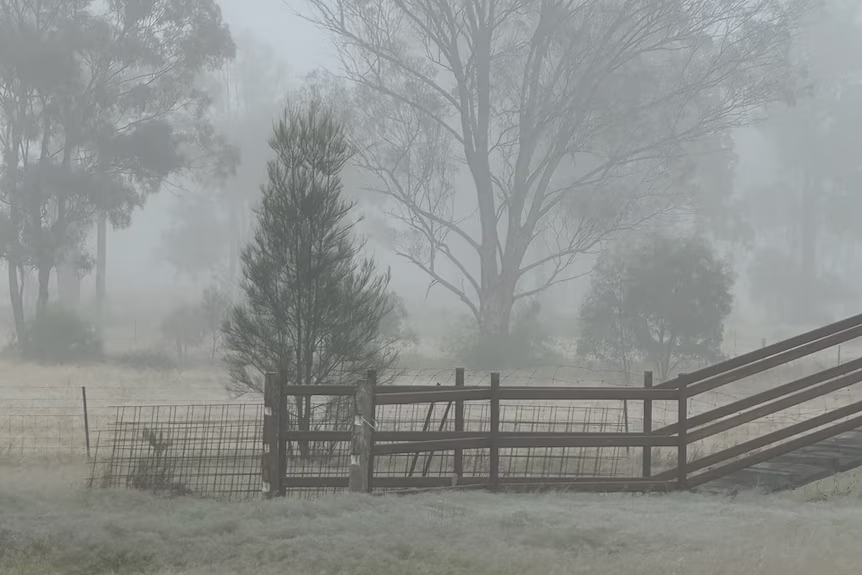
Brisbane Shivers Through Coldest Morning of 2025 as Winter Dry Season Begins
South East Queensland experiences icy temperatures and widespread frost, signaling the start of a cooler, drier winter

Brisbane residents awoke to the chilliest morning of the year on Thursday, with temperatures dipping to 9°C, marking the city’s coldest start to a day in 2025. This cold snap heralds the onset of the winter dry season in South East Queensland, following an autumn that was notably wetter than average.
The Bureau of Meteorology attributes the sudden drop in temperatures to a high-pressure system moving across New South Wales and Victoria, drawing cold air into southern and central Queensland. This system has caused temperatures to plunge to near-freezing levels in several regions.
In the Darling Downs and Granite Belt areas, towns like Oakey and Dalby recorded temperatures around 0°C, with apparent temperatures—factoring in wind chill—falling below freezing. Brisbane itself saw minimum temperatures between 9–11°C, with forecasts predicting continued single-digit lows in the coming days.
Despite the frosty mornings, the days are expected to be clear and sunny, offering some respite from the cold. However, meteorologists warn that another cold front is anticipated early next week, potentially bringing even colder conditions and the rare possibility of snow flurries in high-altitude areas near the Queensland-New South Wales border.
The Bureau of Meteorology’s climatologist, Felicity Gamble, noted that the recent wet conditions are giving way to the drier weather typical of Queensland’s winter. “It has been quite a wet May for South East Queensland, and, in fact, when you look at the autumn period as a whole, much of South East Queensland was substantially wetter than average,” Gamble said.
As the dry season sets in, residents are advised to prepare for continued cold mornings and to stay informed about weather updates, especially with the potential for further cold fronts in the near future.
Weather
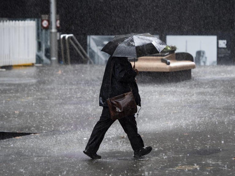
Melbourne Shivers Through Winter’s First Blast as Rain and Wind Dominate King’s Birthday Weekend.
Temperatures dip below seasonal norms with persistent showers and biting winds forecasted across Melbourne this long weekend.

Temperatures dip below seasonal norms with persistent showers and biting winds forecasted across Melbourne this long weekend.
Melbourne Weather Forecast: June 5–11, 2025
| Date | Forecast Description | High / Low Temp (°C) | Precipitation Chance | Wind Conditions |
|---|---|---|---|---|
| Thu 5 | Partly sunny, increasing clouds later | 15 / 8 | 20% | Light winds |
| Fri 6 | Cloudy with afternoon showers; winds becoming strong | 13 / 9 | 60% | Gusts up to 30 km/h |
| Sat 7 | Breezy; some sun, turning cloudy with brief afternoon shower | 14 / 6 | 50% | Breezy conditions |
| Sun 8 | Morning breezes; cloudy with a couple of showers | 12 / 5 | 60% | Breezy in the morning |
| Mon 9 | Cloudy with light afternoon rain | 11 / 8 | 70% | Light winds |
| Tue 10 | Mostly cloudy with light rain | 14 / 8 | 60% | Light winds |
| Wed 11 | Partly sunny | 16 / 8 | 20% | Light winds |
Melbourne is experiencing a significant shift into winter, with a pronounced cold front bringing the coldest conditions of the year thus far. Daytime temperatures are struggling to reach 15°C, while overnight lows are dropping to around 6°C. The Bureau of Meteorology (BOM) has issued a Severe Weather Warning for damaging winds across parts of Victoria, including the Mornington Peninsula and Central Ranges, effective until 5:00 PM AEST on Friday.
The King’s Birthday long weekend is set to be particularly cold and wet. Saturday, June 7, is expected to have a high of 15°C with a 90% chance of rain and strong winds. Sunday will be slightly cooler, with a high of 13°C and an 80% chance of showers. Monday continues the trend with temperatures ranging from 6°C to 13°C and an 80% chance of rain.

Despite this early winter chill, the BOM’s long-range forecast suggests that Melbourne may experience an “unusually warm” winter overall. From June to August, daily maximum temperatures are expected to surpass 15°C, with minimums remaining above 7.5°C. Rainfall levels are projected to be consistent with previous years.
This early winter chill follows an autumn that recorded Victoria’s highest mean maximum temperatures, averaging 1.9°C above the historic norm. The state also experienced its driest winter since 2008, with less than half the rainfall compared to the 1961–1990 average.
As Melbourne navigates this cold and wet start to winter, residents are encouraged to stay informed about weather updates and take necessary precautions, especially during the upcoming long weekend. With the potential for severe weather conditions, it’s advisable to plan indoor activities and ensure safety measures are in place.

Matthew Forde’s Net Worth Revealed for 2025

Brandon King Net Worth in 2025 Uncovered

The Real Price of Cheap Food is Too High and True Cost Accounting Might Finally Be the Fix

College World Series Race Heats Up as Coastal Carolina Shocks Auburn and SEC Giants Battle for Survival

Rovman Powell Net Worth 2025 Revealed

Caitlin Clark Sidelined with Quad Strain, Set to Miss Two Weeks of WNBA Action

Elon Musk Breaks Ranks with Trump Over ‘Big, Beautiful’ Tax Bill

Golden Glory: Team USA Wins First Standalone Ice Hockey World Championship in 91 Years

Eduardo Nunez and Masanori Rikiishi Make Weight, Set Stage for Explosive IBF Title Showdown in Yokohama

China Alleges Taiwan-Backed Cyberattack on Technology Firm
Eduardo Nunez and Masanori Rikiishi Make Weight, Set Stage for Explosive IBF Title Showdown in Yokohama

Magnus Carlsen Silences Critics and Reigns Supreme Over World Champion Gukesh in Norway Chess Thriller
Golden Glory: Team USA Wins First Standalone Ice Hockey World Championship in 91 Years
-

 Sports1 week ago
Blue Jays Humiliated in Tampa as John Schneider’s Comments Raise Eyebrows
-

 Personality6 days ago
Donald Trump’s net worth reveals the fortune behind the former US President and business mogul
-

 Entertainment6 days ago
Top 5 Oscar Moments That Shook Hollywood and the World
-

 Entertainment5 days ago
Jonathan Joss Shot Dead at 59 in Texas Tragedy His Husband Says Was Hate-Fueled Crime
-

 Tech1 week ago
Top 7 AI Tools Every Corporate Employee Should Use in 2025.
-

 Personality5 days ago
Lionel Messi’s Net Worth Revealed and How the Football Legend Built His Multi-Million Dollar Fortune
-

 Films5 days ago
Robert Pattinson’s Top 5 Films That Showcase His Evolution from Teen Idol to Indie Icon
-

 Films6 days ago
James Gunn’s Net Worth Revealed How the Filmmaker Built His Fortune