Weather
Mild Earthquake Rocks Long Beach Leaving Residents Spooked and Talking
A 2.4-magnitude earthquake hit Southern California’s Long Beach, catching locals by surprise with a peculiar sound that had them thinking a car had hit their home

On the evening of June 1, 2025, a small but noticeable earthquake made its presence felt in Long Beach, California. The 2.4-magnitude tremor struck around 11:34 p.m. local time, shaking the coastal city and nearby areas including Signal Hill, Carson, and Rancho Palos Verdes. The United States Geological Survey (USGS) confirmed the event and noted it occurred at a depth of 7.6 miles beneath the surface.
Although it was a minor earthquake by seismic standards, many residents took to social media to share their experiences, with several describing the event as a brief, sharp shake that sounded strangely like a car crashing into the side of their houses. One user wrote, “Very odd earthquake in Long Beach? Sounded like a car hit the side of the house. It was so brief!” Another echoed the sentiment, “Felt it in Signal Hill — a quick shake and then nothing.”
The Long Beach area, which sits in the seismically active Los Angeles Basin, has seen its fair share of earthquakes over the years. This small earthquake is part of the ongoing tectonic activity common in Southern California. While quakes of this size generally don’t cause damage, they are a reminder of the region’s vulnerability to larger seismic events.
In fact, the most devastating earthquake in Long Beach’s history occurred in 1933 when a massive 6.4-magnitude quake struck the city, causing extensive damage and claiming 120 lives. The memory of that catastrophic event still lingers in the minds of many residents, especially during even the slightest of tremors.
Despite this, Long Beach regularly experiences minor earthquakes, with about 59 tremors of magnitude 2.0 to 3.0 occurring each year in the greater Los Angeles area. Most of these go unnoticed, but seismologists keep a close watch on the area, particularly given the proximity to major fault lines such as the San Andreas Fault and the Newport-Inglewood Fault.
Though the June 1 earthquake did not result in any injuries or significant property damage, it serves as a stark reminder for all Southern Californians to be prepared for seismic events of any size. Emergency management officials continue to encourage residents to be aware of earthquake safety protocols and to have a preparedness plan in place.
As Long Beach residents shook off the unsettling tremor, the reminder of California’s constant seismic activity is always there. Whether it’s a tiny shake or a large event, being prepared is key in the land of earthquakes.
Helsinki
Helsinki Weather Forecast for June 8 to 10 2025 Expect Breezy Days and Scattered Showers
Mild temperatures with variable cloud cover and occasional rain mark the early June weather in Finland’s capital.

Residents and visitors in Helsinki can anticipate a mix of sun, clouds, and light rain over the next few days as early June unfolds with typical Nordic variability.
Sunday, June 8:
The day will be partly sunny and breezy, with a high around 19°C (67°F) and a low near 8°C (46°F). Winds from the south to southwest may bring strong gusts up to 15 m/s, prompting a Yellow Warning for Wind in effect until 9:00 PM EEST, as issued by the Finnish Meteorological Institute.
Monday, June 9:
Expect cloudy skies with a couple of showers in the afternoon. The temperature will peak at 17°C (63°F) and dip to 10°C (50°F) overnight. Light rain is anticipated, so carrying an umbrella is advisable.
Tuesday, June 10:
The morning will start with sun and areas of high clouds, transitioning to mostly cloudy conditions in the afternoon. Temperatures will reach a high of 19°C (66°F) and a low of 9°C (48°F). No significant precipitation is expected.
Overall, Helsinki’s weather from June 8 to 10 will feature mild temperatures, intermittent sunshine, and occasional showers. Residents should stay informed about wind advisories and plan accordingly for outdoor activities.
Weather
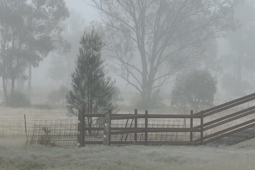
Brisbane Shivers Through Coldest Morning of 2025 as Winter Dry Season Begins
South East Queensland experiences icy temperatures and widespread frost, signaling the start of a cooler, drier winter

Brisbane residents awoke to the chilliest morning of the year on Thursday, with temperatures dipping to 9°C, marking the city’s coldest start to a day in 2025. This cold snap heralds the onset of the winter dry season in South East Queensland, following an autumn that was notably wetter than average.
The Bureau of Meteorology attributes the sudden drop in temperatures to a high-pressure system moving across New South Wales and Victoria, drawing cold air into southern and central Queensland. This system has caused temperatures to plunge to near-freezing levels in several regions.
In the Darling Downs and Granite Belt areas, towns like Oakey and Dalby recorded temperatures around 0°C, with apparent temperatures—factoring in wind chill—falling below freezing. Brisbane itself saw minimum temperatures between 9–11°C, with forecasts predicting continued single-digit lows in the coming days.
Despite the frosty mornings, the days are expected to be clear and sunny, offering some respite from the cold. However, meteorologists warn that another cold front is anticipated early next week, potentially bringing even colder conditions and the rare possibility of snow flurries in high-altitude areas near the Queensland-New South Wales border.
The Bureau of Meteorology’s climatologist, Felicity Gamble, noted that the recent wet conditions are giving way to the drier weather typical of Queensland’s winter. “It has been quite a wet May for South East Queensland, and, in fact, when you look at the autumn period as a whole, much of South East Queensland was substantially wetter than average,” Gamble said.
As the dry season sets in, residents are advised to prepare for continued cold mornings and to stay informed about weather updates, especially with the potential for further cold fronts in the near future.
Weather
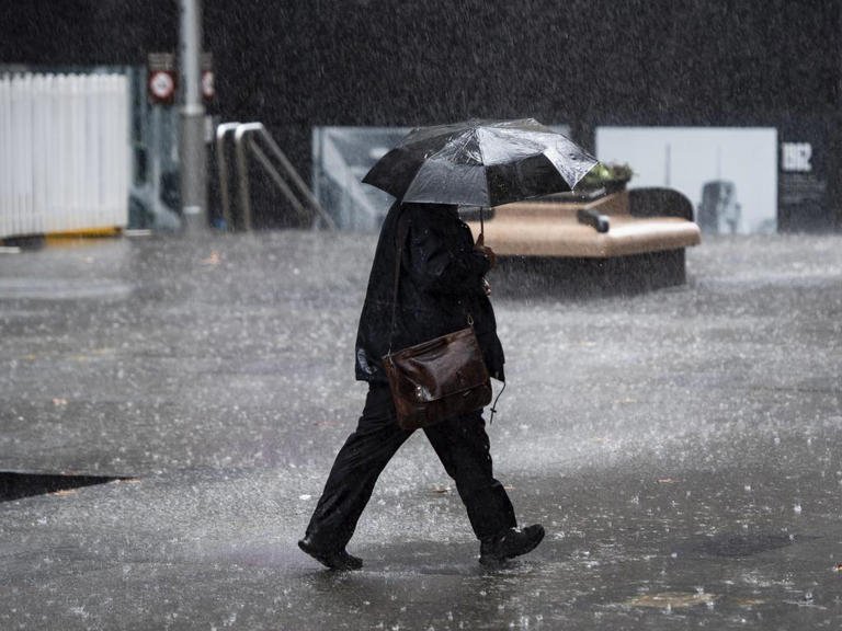
Melbourne Shivers Through Winter’s First Blast as Rain and Wind Dominate King’s Birthday Weekend.
Temperatures dip below seasonal norms with persistent showers and biting winds forecasted across Melbourne this long weekend.

Temperatures dip below seasonal norms with persistent showers and biting winds forecasted across Melbourne this long weekend.
Melbourne Weather Forecast: June 5–11, 2025
| Date | Forecast Description | High / Low Temp (°C) | Precipitation Chance | Wind Conditions |
|---|---|---|---|---|
| Thu 5 | Partly sunny, increasing clouds later | 15 / 8 | 20% | Light winds |
| Fri 6 | Cloudy with afternoon showers; winds becoming strong | 13 / 9 | 60% | Gusts up to 30 km/h |
| Sat 7 | Breezy; some sun, turning cloudy with brief afternoon shower | 14 / 6 | 50% | Breezy conditions |
| Sun 8 | Morning breezes; cloudy with a couple of showers | 12 / 5 | 60% | Breezy in the morning |
| Mon 9 | Cloudy with light afternoon rain | 11 / 8 | 70% | Light winds |
| Tue 10 | Mostly cloudy with light rain | 14 / 8 | 60% | Light winds |
| Wed 11 | Partly sunny | 16 / 8 | 20% | Light winds |
Melbourne is experiencing a significant shift into winter, with a pronounced cold front bringing the coldest conditions of the year thus far. Daytime temperatures are struggling to reach 15°C, while overnight lows are dropping to around 6°C. The Bureau of Meteorology (BOM) has issued a Severe Weather Warning for damaging winds across parts of Victoria, including the Mornington Peninsula and Central Ranges, effective until 5:00 PM AEST on Friday.
The King’s Birthday long weekend is set to be particularly cold and wet. Saturday, June 7, is expected to have a high of 15°C with a 90% chance of rain and strong winds. Sunday will be slightly cooler, with a high of 13°C and an 80% chance of showers. Monday continues the trend with temperatures ranging from 6°C to 13°C and an 80% chance of rain.

Despite this early winter chill, the BOM’s long-range forecast suggests that Melbourne may experience an “unusually warm” winter overall. From June to August, daily maximum temperatures are expected to surpass 15°C, with minimums remaining above 7.5°C. Rainfall levels are projected to be consistent with previous years.
This early winter chill follows an autumn that recorded Victoria’s highest mean maximum temperatures, averaging 1.9°C above the historic norm. The state also experienced its driest winter since 2008, with less than half the rainfall compared to the 1961–1990 average.
As Melbourne navigates this cold and wet start to winter, residents are encouraged to stay informed about weather updates and take necessary precautions, especially during the upcoming long weekend. With the potential for severe weather conditions, it’s advisable to plan indoor activities and ensure safety measures are in place.

The Greatest Debate in Football History Who Really Is the GOAT Ronaldo or Messi

Néstor Lorenzo’s Net Worth Surges to $45 Million Amidst Colombia’s Football Renaissance

The Night Messi Made Football Look Like Magic and Why Many Call Him the True GOAT

Paolo Guerrero’s Net Worth in 2025 Reflects a Storied Football Career

David Lee Net Worth 2025 and How the NBA Champion Turned Smart Investments into Long-Term Wealth

Caitlin Clark Sidelined with Quad Strain, Set to Miss Two Weeks of WNBA Action

Elon Musk Breaks Ranks with Trump Over ‘Big, Beautiful’ Tax Bill

Golden Glory: Team USA Wins First Standalone Ice Hockey World Championship in 91 Years

Eduardo Nunez and Masanori Rikiishi Make Weight, Set Stage for Explosive IBF Title Showdown in Yokohama

China Alleges Taiwan-Backed Cyberattack on Technology Firm
Eduardo Nunez and Masanori Rikiishi Make Weight, Set Stage for Explosive IBF Title Showdown in Yokohama

Magnus Carlsen Silences Critics and Reigns Supreme Over World Champion Gukesh in Norway Chess Thriller
Golden Glory: Team USA Wins First Standalone Ice Hockey World Championship in 91 Years
-
 Sports1 week ago
Caitlin Clark Sidelined with Quad Strain, Set to Miss Two Weeks of WNBA Action
-
 Business & Finance1 week ago
Elon Musk Breaks Ranks with Trump Over ‘Big, Beautiful’ Tax Bill
-

 Sports1 week ago
Blue Jays Humiliated in Tampa as John Schneider’s Comments Raise Eyebrows
-

 Personality5 days ago
Donald Trump’s net worth reveals the fortune behind the former US President and business mogul
-

 Entertainment6 days ago
Top 5 Oscar Moments That Shook Hollywood and the World
-

 Entertainment4 days ago
Jonathan Joss Shot Dead at 59 in Texas Tragedy His Husband Says Was Hate-Fueled Crime
-

 Tech1 week ago
Top 7 AI Tools Every Corporate Employee Should Use in 2025.
-

 Films4 days ago
Robert Pattinson’s Top 5 Films That Showcase His Evolution from Teen Idol to Indie Icon