Weather
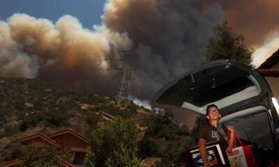
New Jersey Forecast Alert Storms Today Then Scorching Heat With 100°F Monday
From scattered showers and storms this week to a record-breaking heat wave—here’s your New Jersey weather survival guide.

| 68°65° | Mostly cloudy; mist this morning followed by a brief shower or two this afternoon |
| 82°70° | Variable cloudiness with a thunderstorm; humid and warmer; storms can bring flooding downpours and localized damaging wind gusts |
| 91°68° | Warmer with clouds and sun; humid in the morning, turning breezy in the afternoon with a gusty thunderstorm; thunderstorms can bring hail and damaging winds |
| 89°69° | Breezy and less humid with times of clouds and sun |
| 91°70° | Hot with clouds and sunshine |
| 95°77° | Partly sunny and hot |
| 100°80° | Sizzling sunshine and very hot; hottest day since last summer; be sure to stay hydrated |
New Jersey residents should prepare for a week of dramatic weather swings—from rain and storms to a sizzling heat wave topping out at 100°F by Monday.
Early Week (Tue–Wed):
Expect cool, cloudy mornings with mist and patchy fog. Afternoon showers are possible on Tuesday, followed by warmer, humid conditions and scattered thunderstorms on Wednesday. Be ready for sudden downpours and gusty winds.
Midweek (Thu–Fri):
Temperatures rise dramatically on Thursday, reaching 91°F under hazy sunshine and scattered thunderstorms fueled by humidity and strong daytime heating. Winds will gust ahead of each storm, and some cells may bring hail or brief flooding. Friday will bring dryer but still warm weather, with highs around 89°F.
Weekend & Early Next Week (Sat–Mon):
Only partial cloud cover expected Saturday, with heat climbing to the low 90s. Sunday continues the trend, warming into the mid-90s. Monday is the standout day—expect 100°F and potentially record-breaking heat, with little relief overnight as lows remain in the upper 70s and humidity spikes.


Weather
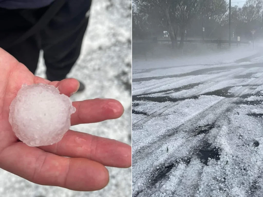
Fierce Storms with 5cm Hail and 110km Winds Set to Smash Australia’s East This Weekend
Queensland, NSW, Victoria, and Tasmania brace for torrential rain, giant hail, and dangerous winds as BOM issues severe warnings.
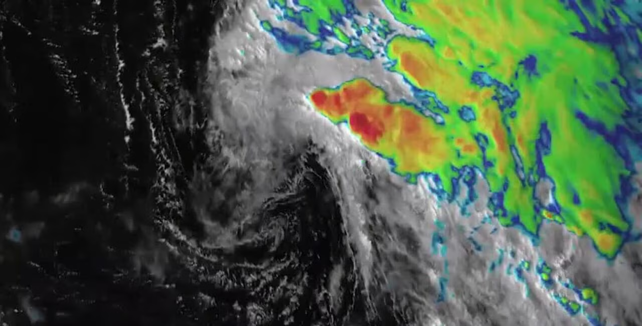
Australia’s eastern states are preparing for a turbulent weekend, as Bureau of Meteorology (BOM) forecasters warn of fierce storms, torrential rainfall, and hail as large as 5cm in diameter. Residents from Queensland to Tasmania have been told to secure property, expect power outages, and avoid unnecessary travel as the weather system intensifies.
Meteorologists say the weather chaos is being driven by a low-pressure system swirling over Great Australian Bight, dragging frigid polar air northward. At the same time, warm, unstable air masses across inland Queensland are fueling thunderstorms that could turn severe.
Queensland Hit First
By Friday afternoon, storms had already begun firing up across South East Queensland, with regions such as Ipswich, Scenic Rim, Lockyer Valley, Toowoomba, and Kingaroy facing winds in excess of 90km/h and hailstones up to 5cm.
Harry Clark, senior meteorologist at the BOM, explained:
“We’ve got a fairly warm air mass in place that’s giving us energy. A trough moving in from the west will turn that energy into thunderstorms. Any severe storm could bring wind gusts above 90km/h and giant hail.”
The BOM has also warned that the system will linger into Saturday, with Brisbane and the Gold Coast likely to see gloomy skies, scattered showers, and a slim chance of more thunderstorm outbreaks.
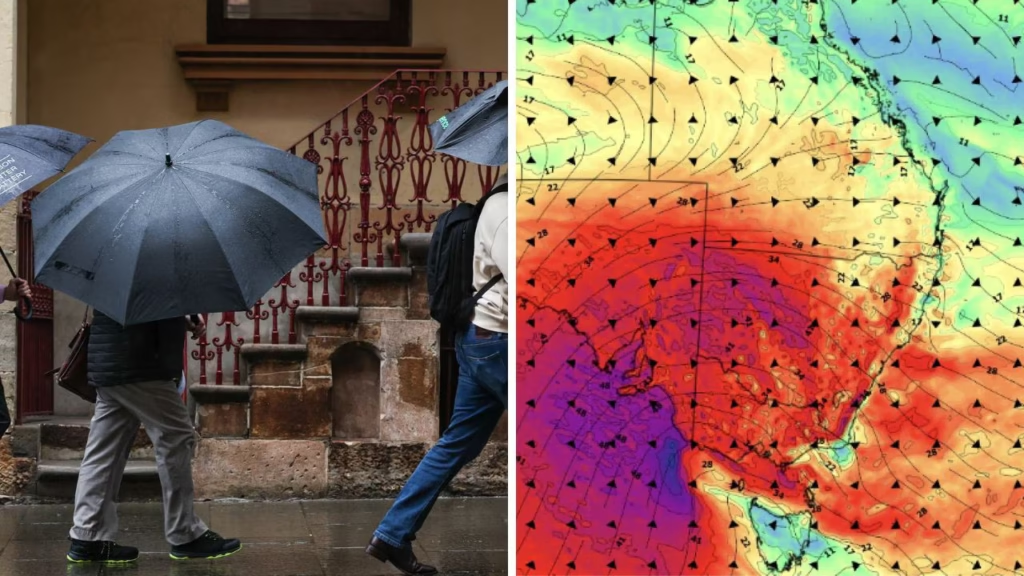
Victoria and NSW Under Threat
While Queensland braces for hail, Victoria and New South Wales are expected to see widespread thunderstorms and damaging winds from late Friday into Saturday. Gusts of up to 110km/h are forecast for northern Melbourne, the Dandenong Ranges, the Mornington Peninsula, and the Snowy Mountains.
Miriam Bradbury, a BOM meteorologist, said:
“We do have severe weather warnings in place for damaging winds across Victoria and NSW. As the stronger cold front arrives, rain will ramp up across inland parts of the east, spreading into South Australia as well.”
Tasmania to Be Battered
Further south, Tasmania will not be spared. Warnings have been issued for the Western District, Upper Derwent Valley, Central Plateau, and South East. The island state is expected to see bursts of rain, hail, and even snow flurries on Saturday as another cold front sweeps through.
According to Bradbury, the second system will be “extensive” and could bring more than one day of disruptive weather.
The Broader Picture
Satellite imagery from Weatherzone has shown speckled cloud masses spreading across the continent, highlighting the polar air driving this outbreak. By Saturday, thunderstorms are forecast to stretch from southern inland Queensland all the way down to Victoria, with the heaviest rainfall totals linked directly to storm cells.
This severe pattern follows a year of heightened climate volatility across Australia, driven by shifting ocean currents and stronger cold fronts funneling through the east. It comes only months after parts of Sydney and Melbourne were hit by flash flooding and destructive winds.
What Residents Should Do
Authorities are urging communities in the path of the storm system to take extra precautions. Residents are advised to:
- Secure outdoor furniture and loose objects.
- Charge mobile devices in case of power outages.
- Stay indoors when warnings are issued.
- Avoid driving through flooded roads.
Emergency services have also warned about the risk of localised flash flooding, particularly in low-lying areas and river catchments.
Human Impact
While forecasts focus on hail size and wind speeds, the human impact is also a concern. Farmers across Toowoomba and the Lockyer Valley, known for their rich agricultural output, fear the hail could destroy crops just weeks before harvest. In Brisbane, small businesses have been racing to cover stock and secure shopfronts ahead of the storm.
For many families, the weekend will now mean staying indoors, with events canceled or postponed. Sporting fixtures in Queensland and NSW have already been called off.
Final Word
The ferocity of this weather system has caught the attention of meteorologists and the public alike. As BOM warns of multiple cold fronts hitting simultaneously, Australians are once again reminded of the country’s unpredictable climate.
Stay connected with Daily Global Diary for live updates, safety advisories, and ground reports from across the east coast.
Australia
Product Safety Tick Means Showtime Fun Is In Bag 2025 Surprise Revealed
Melbourne Royal Show showbags cleared after strict inspections ensuring kids’ safety comes first
The countdown to the Melbourne Royal Show has officially begun, and with it comes one of the most beloved traditions of the event — the showbags. This year, the excitement is not just about the goodies inside but the assurance that every product has been thoroughly vetted for safety.
On the eve of the 2025 festivities, Nick Staikos, Minister for Consumer Affairs, joined 20 thrilled children at the Victoria Pavilion to reveal what’s inside the showbags and, more importantly, to highlight the work behind making sure families can enjoy them without worry.
The event marks the culmination of months of preparation by Consumer Affairs Victoria (CAV), which has been inspecting showbags at the Royal Show since the mid-1980s. This year, inspectors carried out comprehensive safety checks across more than 320 showbags and 2,300 individual items.
Why product safety matters at showtime
For generations, the Melbourne Royal Show has been a cherished springtime tradition. Families flood into the showgrounds, kids run toward rides and food stalls, and parents know the trip wouldn’t be complete without the excitement of a showbag. But what many may not realize is that behind the fun lies a serious safety process.
CAV officers screened every toy, cosmetic, and novelty item against Australian Consumer Law. Their inspections found 15 products that breached standards — including unlabelled cosmetics, unsafe projectile toys, sunglasses lacking supplier details, and toys posing choking hazards. These items were either corrected or pulled from circulation before opening day.
“Showtime in Melbourne has been a cherished and enduring springtime tradition for Victorian families for 177 years, and our inspectors are on the ground working to ensure safety and peace of mind for both children and parents,” Staikos said during the preview.
Strict penalties for unsafe products
The safety team doesn’t stop after the initial inspections. Officers will continue to conduct random checks throughout the event. They hold the power to seize unsafe goods on the spot and can issue fines of up to AUD $5,000.
For companies or individuals that repeatedly break safety laws, the stakes are far higher: penalties can reach AUD $2.5 million for individuals and an eye-watering AUD $50 million for corporations.
Such strict measures reflect the seriousness of protecting families. It’s not only about fun — it’s about trust.
A proud partnership keeping traditions alive
The inspections are carried out in collaboration with the Royal Agricultural Society of Victoria (RASV), the body that organizes the Melbourne Royal Show. According to RASV CEO Brad Jenkins, the relationship with CAV has been vital in keeping the showbags tradition safe and enjoyable.
“We are proud of our ongoing partnership with Consumer Affairs Victoria and are grateful for the work they do in ensuring all showbags at the Melbourne Royal Show are safe for families to enjoy,” Jenkins noted.
This partnership, dating back nearly four decades, shows how community safety has evolved alongside the entertainment itself.
The tradition of the Melbourne Royal Show
First held in 1848, the Melbourne Royal Show has grown into one of Australia’s most iconic annual events. For 177 years, it has blended agriculture, entertainment, and family fun — with showbags becoming its most iconic feature.
From novelty toys and confectionery to exclusive branded merchandise, showbags are a cornerstone of childhood nostalgia in Victoria. Parents who once carried them as children now pass the tradition to their own kids.
The 2025 edition will run from Thursday, September 25 to Sunday, October 5 at the Melbourne Showgrounds.
Families can attend with confidence
With inspections wrapped up and non-compliant products addressed, visitors can head to the show knowing their fun is “in the bag.” This year’s safety tick assures parents that their children’s delight won’t be clouded by hidden risks.
Consumer Affairs Victoria continues to remind vendors and visitors alike that safety is everyone’s responsibility. And for the thousands expected to walk through the gates, the focus can remain on laughter, rides, food, and — of course — the thrill of ripping open a showbag.
For more updates on stories like this, visit our site for more news www.DailyGlobalDiary.com.
Melbourne Royal Show 2025 Showbags Get Safety Tick After Inspections
Australia
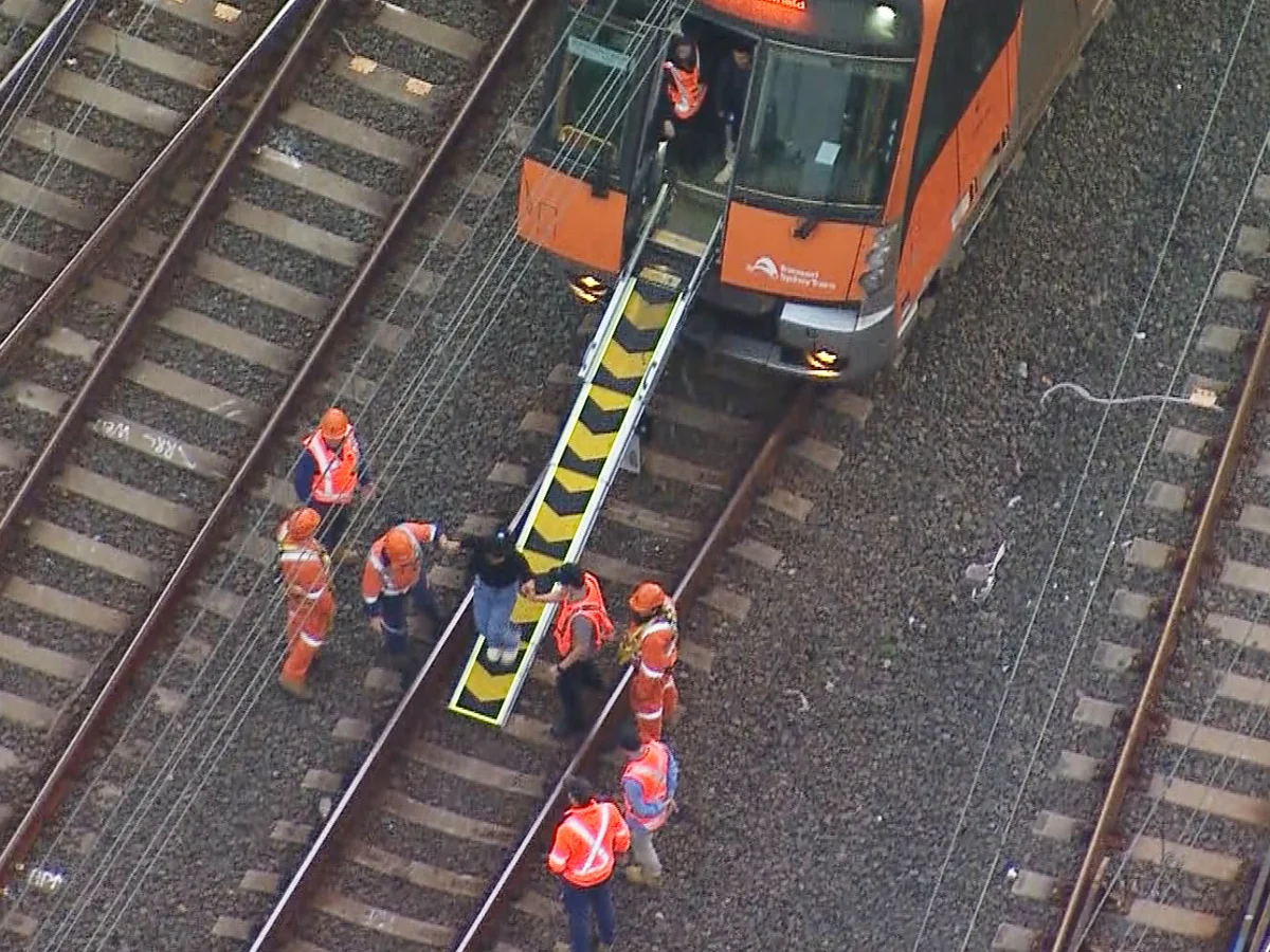
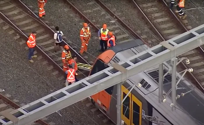
Sydney train delays leave thousands stranded after one fatal incident shocks commuters
Sydney’s busiest train lines — T1, T2, and T3 — were thrown into chaos after a tragic incident at Flemington Station, forcing commuters into hours of delays and confusion.
Sydney commuters trapped in Monday morning chaos
A routine Monday morning commute turned into hours of frustration for thousands of passengers across Sydney after a fatal incident at Flemington railway station caused widespread delays across the city’s rail network.
Authorities confirmed that a man died shortly after 5:30 a.m. at the station in what police believe to be a mental-health-related incident. While tragic on its own, the timing and location of the event sent shockwaves through the Sydney Trains system, particularly during the morning peak.
Services on the T1 North Shore & Western Line, the T2 Leppington & Inner West Line, and the T3 Liverpool & Inner West Line were all impacted, leaving commuters scrambling to find alternative transport.
Sydney Trains chief executive Matt Longland addressed the disruptions during a live interview on radio station 2GB, noting that emergency services had forced diversions around Flemington, which in turn affected the Blue Mountains line.
“We’ve got multiple tracks through the area, which is good news, but those delays will flow into the T2 and the T3,” Mr Longland explained.
Chaos spreads through Sydney’s rail arteries
By 6:30 a.m., passengers at major hubs such as Central Station and Parramatta reported long queues, with some trains canceled outright and others stopping at unexpected stations.
A statement from Sydney Trains urged passengers to “allow plenty of extra travel time” and warned that “stops may change at short notice.”
For many office workers, students, and shift employees, the lack of certainty created an avalanche of delays across workplaces in Sydney’s CBD. Ride-share apps like Uber and Ola surged in pricing as stranded passengers scrambled for options.
Commuter frustration boils over
On social media platforms such as X (formerly Twitter), frustrated commuters shared images of overcrowded platforms and packed carriages. Hashtags like #SydneyTrains and #TrainChaos began trending by 7:00 a.m.
One commuter wrote:
“Waited 40 minutes for a train at Strathfield. When it finally came, it skipped my stop. Absolute nightmare.”
Another shared:
“This is why Sydney needs more reliable infrastructure. A single incident shouldn’t paralyze the entire network.”
Expert voices raise concerns
Urban transport analysts say the disruption highlights Sydney’s vulnerability when one major hub goes offline. Infrastructure Australia has previously flagged rail congestion as a “high-risk issue” for the growing city.
According to transport expert Professor David Hensher from the University of Sydney, reliance on a few key junctions leaves little room for redundancy:
“When a single node like Flemington is taken out, it reverberates across multiple lines. This isn’t just about today — it’s about systemic weaknesses in Sydney’s rail network.”
Official response and recovery timeline
Mr Longland reassured passengers that services were expected to normalize around 9:00 or 9:30 a.m. once clearance was given by emergency services.
However, he admitted delays would “flow through the morning peak” as trains were rerouted and timetables rebalanced.
Transport for New South Wales released a statement offering condolences to the family of the deceased man and reiterated the availability of mental health support through Lifeline at 13 11 14.
Broader implications for Sydney commuters
While services slowly resumed, many commuters noted the cascading effect — late arrivals to work, missed school drop-offs, and medical appointments disrupted. For some, it meant hours of unpaid time lost.
The incident has reignited debate about the adequacy of Sydney’s public transport system, particularly as the city grows toward a projected population of six million. Critics argue that reliance on central choke points makes the system fragile, while advocates say the investment in new lines like the Sydney Metro could provide much-needed relief.
Human side of the tragedy
Beyond the logistical nightmare, today’s disruption began with the loss of a human life. Police confirmed that the incident at Flemington was not being treated as suspicious but rather as a mental health emergency.
Mental health advocates are urging for greater awareness, noting that Australia’s suicide rate remains a serious public health issue. Beyond Blue emphasized the importance of community support, particularly during stressful economic times.
The road ahead
For now, Sydney’s commuters will remember August 25, 2025, as another morning when the fragility of their transport system was laid bare. As one passenger put it bluntly:
“One incident, and the whole city grinds to a halt. How is that acceptable?”
Whether today’s tragedy sparks long-term reform or becomes another entry in the long list of Sydney rail disruptions remains to be seen.
Visit our site for more news www.DailyGlobalDiary.com

Brendan Carr to face Senate grilling after “free speech firestorm” over Jimmy Kimmel controversy — Ted Cruz calls remarks “dangerous as hell”

OpenAI reverses course after Hollywood backlash — Sam Altman promises “granular IP control” and potential revenue share for creators in Sora

Charlie Hunnam reveals chilling transformation into serial killer Ed Gein for Ryan Murphy’s Monster… “I didn’t want to glamorize it”

Lesbian comedian Jessica Kirson apologizes for performing in Saudi Arabia’s Riyadh Comedy Festival… “I made a poor decision I deeply regret”

Baby oil, “freak offs,” and shocking celebrity testimonies — inside Diddy’s explosive sex-crimes trial that shook the music industry

Donald Trump’s net worth reveals the fortune behind the former US President and business mogul

1-Iran Issues Dire Warning to Israel and Defies Trump on Nukes: “We’re Ready to Strike Deep Inside”

Caitlin Clark Sidelined with Quad Strain, Set to Miss Two Weeks of WNBA Action

Elon Musk Breaks Ranks with Trump Over ‘Big, Beautiful’ Tax Bill

Golden Glory: Team USA Wins First Standalone Ice Hockey World Championship in 91 Years

Apple delays Jessica Chastain thriller The Savant about domestic extremism after recent US violence

Avatar 3, Fire and Ash trailer reveals Jake Sully’s family facing terrifying new Na’vi enemies with deadly fire powers

7 Powerful Lines from Jessica Simpson’s Fade Song That Reveal the Truth Behind Her Breakup

Emma Watson Banned From Driving After Speeding Offences Shock Fans in 2025

Swag or Surprise Justin Bieber’s Mysterious New Album Drops Friday With Gunna Sexyy Red, and Cash Cobain — But That’s Not All
-

 Entertainment1 week ago
Alyssa Milano removes breast implants says she finally feels free and authentic
-

 Sports1 week ago
Seattle Mariners end 24 year drought as Cal Raleigh belts No 60 to clinch AL West crown
-

 Sports1 week ago
Lionel Messi scores twice with assist as Inter Miami crushes New York City FC fans stunned by his masterclass
-

 Technology News1 week ago
China opens Shanghai digital yuan hub to rival US dollar but here’s the bigger plan
-

 Entertainment6 days ago
Dolly Parton delays Las Vegas concerts by nine months citing health challenges but promises unforgettable return
-

 Politics1 week ago
US Senate to grill Coinbase executive as crypto tax fight heats up next week
-

 Entertainment1 week ago
Scarlett Johansson breaks silence on Colin Jost’s SNL future fans surprised by her answer
-

 Entertainment6 days ago
Zoey Deutch engaged to comedian Jimmy Tatro after 4 years of dating with romantic beach proposal